
A Missing Link Completed (PCT)
- Connard Hogan
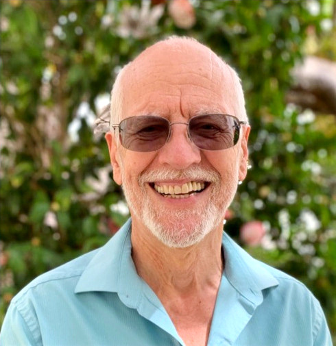
- Oct 20, 2022
- 7 min read
Updated: Jan 7
Bottom line: I like to tidy up.
10/4/22 (Day 0, “The Rendezvous”) - “Wrong-way” Mark and I met at Cajon Pass Inn, rehashed our trip’s hike plans over dinner, then settled into our respective motel rooms early in preparation for tomorrow.
We wanted to backtrack on the PCT and hike a section skipped earlier this year due to snow conditions. Though I’m not a purist, by any means, I’d told Mark I preferred to hike every mile of the PCT, within reason, to which he concurred, as we have the opportunity. Consider it a personal challenge, and paint me stubborn and a glutton for punishment. Most through-hikers, taking one shot at hiking the entire trail, choose one direction and “go for it.” However, many skip portions due to trail closures and weather conditions.
10/5/22 (Day 1, “Southbound, Ho”) - Mark and I settled on a southbound hike along today’s section, which would provide us a predominately downhill experience. Who would argue?
After a McDonald’s take-out breakfast at 5:45AM, which provided my stomach something with which to occupy itself, we dropped Mark’s car on the rough, unpaved road 3N29, about one mile downhill from its junction with the PCT. From there we drove my car back through Wrightwood, continued up Hwy 2 to Inspiration Point where we turned left onto 3N26, then proceeded the six miles to Guffy Campground.
Under clear sky, temperature somewhere in the mid-60s, we enjoyed a comfortable start at 7:55AM.

Northward view towards the
Mojave Desert environs.
Panoramic views came and went along the route. Thankfully, my feet tolerated the hike, though my sweat-fest began, spurred on by the rising temperature.

During a brief pause, Prim8
looks at the terrain ahead.

Mt Baden-Powell awaits us.
We completed our day’s objective, arriving at my car at 1:45PM.
Driving my car to Mark’s, we noted the air temperature to be 84 degrees. Meanwhile, I noted my feet and lower back complained, though both more as a nuisance than a hindrance.
So that I could purchase sunscreen, Mark and I drove our vehicles to Mountain Hardware in Wrightwood, the geographic center of town I’d estimate. By the time we'd arrived at the store, my leg muscles had stiffened, which didn't surprise me. Over the years, I've grown accustomed to the hiking aftermath of aches and pains.
In addition to sunscreen, I selected a tube of GU lime-flavored electrolyte tabs as we browsed. FYI, GU produces a range of edible supplements, including energy gel packs. I recommend the vanilla bean gel packs for a quick trail pick-me-up or after dinner dessert for those sugar-rush cravings. Yum!

"Wrong-way" weighs the utility
of this culinary cookbook.
Our hike covered 16.7 miles, from mile-markers 364.4 to 347.3 (as measured northbound).
10/6/22 (Day 2, “Adapt and overcome”) - Mark and I enjoyed a sit-down breakfast at the Village Grind & Wine Cellar in Wrightwood before we navigated the winding turns up Hwy 2 past Inspiration Point and onto Vincent Gap.
I parked my car in the paved parking area at the highway junction, and after a dusty, bumpy ride of six miles on the partially paved road, designated 3N26, to Guffy Campground, we left Mark’s car at 8:10AM.
The ~10-mile trail to my parked car provided continued panoramic views of the Mojave plains to the north.

Looking north towards the
Mojave Desert plains.
The cool temperature again afforded us pleasant hiking conditions. The weather remained good, and my feet offered no major hindrance. Hour after hour we plodded onward, mostly down grade.
Afterward, like the day before, my car’s temperature gauge crept upward, though now it continued to climb as we crawled towards Guffy Campground. I speculated as to the cause, since I’d recently had a general maintenance done. Regardless, when the gauge neared the red zone and water vapor escaped from under the hood, we knew something was amiss. After I pulled over to access the problem and raised the hood, we could see that the engine was overheating. Steam hissed from the hose which was disconnected from the overflow reservoir.
No! Prim8 said.
We’ll just need to deal with it, guy. Adapt and overcome.
We continued a short distance, before the engine heated to the critical level again. Then, Mark volunteered to hike the remaining distance to his vehicle, perhaps three miles, providing me the opportunity to coax my car back to the junction at Hwy 2. If I could get my car there, I’d wait for Mark . . . or continue on into Wrightwood, depending on my assessment of the situation. Along the way, by chance, I paused at an overlook where I got internet and phone connection. I phoned Wrighwood Automotive Services and learned they’d be open until 5PM, and could probably do the necessary repair work the next day.
Yippee! Prim8 squealed.
Don’t hold your breath just yet, guy, I warned.
I also discovered a tow truck would need to come from Hesperia or Phelan.
Crap. No way a tow truck will get my car to Wrightwood by 5PM today.
I limped out to the Hwy 2 junction and waited. Once again, I had no phone service.
Again? Prim8 said.
Yep. No real surprise in these mountains.
I debated my next move. Drive my car to Wrightwood, all downhill? Wait for Mark? Arrange a tow? A tow would surely delay repairs and our trip schedule. Calculating that the downhill drive to Wrightwood wouldn’t be fatal for my car’s engine, I proceeded. I got my car to the repair shop at about 3:30PM without overheating, then left it in their hands to diagnosis the situation.
All the while I mulled various manners of repair outcomes intertwined with Mark’s and my hiking trip. When would my car be available to me again? Could we maintain our hike schedule or even complete our plans?
Previously, we'd planned to hike an additional section today from Islip Saddle, the 3rd trail crossing of Hwy 2 at mile-marker 386.0 to the 4th trail crossing of Hwy 2 at 389.3. Without a second car, but willing to hump the additional distance, we committed to hiking it anyway, by waking along Hwy 2 back to Mark’s car.
We left his car in the Islip Saddle parking lot at 4PM and made it to the 4th trail crossing of Hwy 2 at 6:15PM.
After the repair shop had closed, I arranged, via text messaging with Tom, one of their staff, for replacement of the water pump and timing belt. A relief to me, Tom indicated that the necessary repairs could likely be completed the next day. I gave the go-ahead for the recommended repairs.
At least, I could rest easier knowing my car would be fixed and I’d have it back by Saturday morning, latest, unless another problem was discovered. But down one car, Mark and I would need to “adapt and overcome” in order to salvage our original hiking schedule plans.
With the two sections hiked today, we notched an additional 12.7 miles to our trip hiking so far.
10/7/22 (Day 3, “A Trail Angel Exercises Her Wings”) - Straight-away after breakfast and wanting to verify my car’s repair plan, Mark and I dropped by the auto repair shop.
Once I’d satisfied myself regarding the repair plan, Mark and I asked about potential rides to Hwy 2 junctions along the trail. All fingers pointed to the local hardware, which served as the town’s PCT hikers’ hub and where I was provided numerous trail angel phone numbers. First angel I phoned, Carol S, agreed to provide a shuttle ride for Mark and I from Islip Saddle to Vincent Gap.
Thanks to her assistance, hope flourished that we could maintain our trip schedule after all.
We bade goodbye to Carol at the Vincent Gap parking lot, providing her a pay-it-forward recompense for her time and trouble. Then, Mark and I started up Mt Baden-Powell’s flank at 10:45AM. Good weather, temperatures in 60’s-70’s, prevailed as we traversed switchbacks in the shade of conifers and scattered clouds.

A wizened trail-ridge local.
With steady progress along the sixteen-mile length of trail, we arrived at Mark’s car at 5PM.
Immediately, we proceeded to the auto repair shop in Wrightwood, arriving ~5:30P. Viola, my car repairs had been completed, so I reclaimed my car.
Yippee! Prim8 exclaimed.
Yeah, good fortune shines upon us, I replied.
My beer and sandwich at the Wrightwood Brew Company tasted especially delicious.
10/8/22 (Day 4, “Those Frog Legs Ain’t For Eatin’”) - Northbound (NOBO) again, we got a late start (10AM) from mile-marker 389.3, Eagles Roost Picnic Area. Only a few yards off Hwy 2, we studied the detour sign directing that hikers use the alternate trail which by-passed the Mountain Yellow-legged Frog habitat. Hadn’t noticed that detour on the half-mile notes, but, sure enough, it was right there in print.
Yellow-legged frogs? Prim8 wondered.
Never heard of ‘em, fella, I said.
I surely didn’t want to step on a remaining specimen of endangered frog, yellow-legs or no, nor did Mark, so we followed the alternate route. Nor did we want to face a possible fine by ignoring the detour. The alternate route led us along Hwy 2, then via Buckhorn Campground along Burkhart Trail for 2.2 miles to rejoin the PCT.
At that juncture of trail we encountered signs warning of burn and snag hazards.
When Prim8 looked at the first sign, he asked, Loose and arm or leg?
Don't worry. That's referring to tree limbs, I said.

Mark passes warning signs.
I perspired profusely despite continued cooler temperatures, while clouds in the distance suggested possible rain. Humidity wasn’t doing me any favors, I guess.
We weren't snagged along the route, though our unplanned detour added ~1.5 miles to today’s overall distance. Nevertheless, we finished at 4:35PM for 13.9 miles of trail distance from mile-marker 389.3 to 403.1.
1/9/22 (Day 5, “A Minor Victory”) - From Mark’s car at Three Points Trailhead at Hwy 2, mile-marker 403.1, we proceeded northbound at 8:30AM.
Partial cloud cover helped keep temperatures mild throughout the day. Welcomed cooling breezes, helped reduce, though didn’t prevent, my sweating. More than once I noted the accumulated salt-deposit build up on my hat and shirt.
As the day wore on, my feet complained with every step and my lower back ached, but I knew each step brought me closer to my car. The trail seemed to drag on, particularly after my car came into view in the distance.
Tiny, Prim8 noted.
“It’s the size of a flea,” I said to Mark.
Hurry up! Prim8 complained.
Keep putting one in front of the other, dude.
Rain fell over nearby mountains while thunder clapped as we finished another 15.7 miles of trail in dry conditions.
“We gained 1,900-foot-plus elevation for the day overall,” Mark reported.
Knackered, I said, “Certainly felt like it to me.”
Our tally this trip: mile-marker 347.3 (Swarthout Canyon Road) to 418.6 (Mill Creek Fire Station), covered the 71.3 miles by-passed earlier this year due to snow conditions.
Technically, I’ve hiked the PCT from the Mexican border to Hwy 58 junction at Tehachapi Pass, mile-marker 566.4. Though in 2017 I walked the detour route along Hwy 74 from Paradise Valley Cafe junction to Saddle Junction above Idllywild, mile-markers 151.9 to 179.4, I plan to hike that section of trail, which has since reopened.
Walk in beauty.


Comments