- Connard Hogan
- Dec 27, 2025
- 11 min read
Updated: Jan 8
Bottom line: You need to request the caviar (of life)!
Janet and I recently joined the Seabourn Sojourn on a 22-day cruise from Miami to Long Beach via the Panama Canal.
Tuesday, Nov 25 - Our first priority after boarding was lunch ... and since we knew we could order caviar ... we did! (And, since we both love seafood, we promised ourselves to order it on a regular basis.)

Janet enjoys her first
serving of caviar on-board.
Wednesday, Nov 26 (At sea) - As we normally had done on previous cruises, we attended the lectures/presentations on-board, having found most to be entertaining and informative.
Our first day, Dr. Ben Taggie presented on King Sugar.
1) Columbus introduced sugar cane to the New World on his second voyage in 1493.
2) The year 1651 CE marked the first mention of rum, at that time made from sugar cane molasses (now made with sugar beets).
3) Four million slaves were imported to the Caribbean between 1700-1850 CE to work in the cane fields (hot, hard labor).
Dr. Sofia Laurein presented The "Golden Age" of Caribbean Piracy: Skull and Crossbones on the Horizon (1650-1720).
4) Pirates wore earrings as commemoration for their first crossing of the equator.
5) Their earrings, usually gold, served as pre-need currency for a "proper" burial.
6) The first real democracy occurred on pirate ships in the New World, as all the pirates shared in the bootie and could leave of their own free will.
7) Sir Francis Drake created the Mojito, the first cocktail, to treat scurvy. (Got my attention!)
Thursday, Nov 27 (At sea) - Janet and I observed Thanksgiving by consuming our share of caviar!
Dr. Sofia Laurein presented A Cultural History of Coffee: How We Fell in Love with Caffeine.
8) Circa 6th century CE , coffee was consumed like "energy bars" in Ethiopia (unsweetened, of course).
9) Kiva Han, the first known coffee house still in operation, started in 1475 (during the Ottoman Empire) in Constantinople.
10) Pope Clement VIII baptized coffee as a Christian drink around 1600. (Prior to that it had been considered satanic.)
11) Coffee became the preferred drink in the US colonies following the Boston Tea Party of 1773.
12) The custom of tipping servers was born in English coffee houses.
13) Coffee trees DO NOT produce beans. Remember that the next time you're grinding your coffee seeds! (BTW, the same goes for cocoa, a recommended ingredient of chocolate.)
"Jack" Garcia, former FBI agent, presented about his experiences of undercover work.
14) Apparently, there's controversy in Boston (or thereabouts) as to whether spaghetti gets covered with a sauce or gravy. And, there I was, thinking my whole life that spaghetti always got covered with sauce!
Dr. Taggie presented The Fascinating Story of the Discovery and History on the Dominican Republic.
15) The ancient Greeks were calculating the circumference of the earth several hundred years BCE. I fact checked that. Eratosthenes (c. 276–194 BCE) is credited with an estimation of 25,000 miles. (Current measurements are 24,901 miles at the equator, and 24,860 miles through the poles, as earth is NOT a perfect sphere.)
16) Santo Domingo, founded 1496, became the first European settlement in North America.
17) The Dominican Republic almost became a US state in 1870 during Grant's presidency.
Friday, Nov 28 (Isla Catalina, Dominican Republic) - The Sojourn anchored off the island, then tendered passengers in for some "Caviar in the Surf and Beach BBQ." Janet and I had a relaxing lounge, accompanied by caviar and followed by lobster! Yum!

The ship sits anchored
as Janet and I lounge.
Saturday, Nov 29 (At sea) - Moderate rough seas proved nothing more than a test of sea legs ... at least for me. Janet donned her wrist bands, which have something to do with acupressure.
We attended the "at sea" presentation by Dr. Ben Taggie entitled The ABC Islands, a Jewel of the Amazing Dutch Empire in the 17th Century. (For clarification: Aruba, Bonaire and Curaçao.)
18) The "Golden Age" of the Dutch empire occurred in the 17th century CE, as they possessed the largest navy.
19) The Dutch captured the ABC islands around 1636. In part, it seems, because the Spanish considered the islands "useless," as they weren't a source of gold/silver.
20) The East India Trading Company became the first "trade stock exchange company."
Sunday, Nov 30 (Willemstad, Curaçao) - Janet strolled along the waterfront of the Otrobanda and Punda quarters of Willemstad, using the ferry to cross St. Anna Bay when the Queen Emma Pontoon Bridge was open (to allow a ship to pass).

The Queen Emma Pontoon Bridge
swings closed to accommodate
foot traffic.
We recrossed the bay via the closed foot bridge.

Punda Quarter, Willemstad, waterfront.
(Note the Dutch style architecture.)
I spotted this gorgeous mural in Otrobanda.

The "Djosa" mural.
(Francis Sling, 2024)
Monday, Dec 1 (At sea) - "Jack" Garcia lectured about Chasing Down Drug Dealers. (Interesting ... and dangerous.)
Dr. Ben Taggie presented The Spanish-American War and It's Important Contribution to the Successful Building of the Panama Canal.
21) As a result of the heavy casualties from yellow fever during the Spanish-American War, a cure was sought and found. As deaths from diseases, such as yellow fever, had stymied the first attempt to build the Panama Canal by the French, the subsequent cure assisted a second, and successful, attempt by the Americans.
Dr. Sofia Laurein provided us An Entertaining History of Your Favorite Food.
22) Extinguish the myth (British propaganda) that Napolean was short in stature. To wit, Napolean was three-quarters of an inch taller than the average man of his day. (Some food items are named after him. However, since those food items aren't among my favorite, I found the above fact more interesting.)
23) James Salisbury, physician during the American Civil War, created Salisbury steak, since he thought veggies produced poisonous substances, which caused numerous, severe health conditions, including mental illness.
24) Round blocks of hard cheese were used as cannonballs in a naval battle!
25) French fries originated in French speaking BELGIUM.
Tuesday, Dec 2 (Santa Marta, Columbia) - Janet and I checked out sites of the town, including the "Tayrona Gold Museum" (free entry).
Tairona society (Pre-Columbian) created impressive, intricate gold-work ornamentation, though I was amused by one clay shamanic object. It's purpose was to frighten people. I'm doubtful it has that effect on you, though perhaps it would on young children.

Tairona society shamanic figurine.
Wednesday, Dec 3 (At sea, Atlantic Ocean) - Dr. Sofia Lauren provided An Entertaining History of Money. We learned about various early items/substances used as currency, such as salt and leather.
26) The term "cash cow" originates from gifting a milk-producing cow at someone's birth, as the on-going flow of milk could be sold.
Melissa Fung presented Living with Trauma: A PTSD Journey. She told us about her ordeal as a journalist taken hostage in Afghanistan, and held in a dark, cramped space for about 30 days. She placed emphasis on the on-going work and positive attitude of personal growth. (I'll second that!)
Thursday, Dec 4 (Panama Canal) - Our ship began the transit of the Panama Canal system when we entered Gatun Lake early morning. I'd barfed twice during the night (cause undetermined), so started my day late and in a slow, sluggish state. Janet and I went topside at 2:30 PM to watch the progress of our ship's canal transit, and I spotted a huge ship transiting the newer canal adjacent to us.

The "Magellan." Carrying fuel? LPG?
Friday, Dec 5 (At sea, Pacific Ocean) - Dr. Sofia Laurein continued her talks with The History and Mystery of the Mayan Civilization.
27) About ten million people comprised the Mayan civilization.
28) They worshiped the "Corn God," valued beauty, and so elongated their skulls to replicate the shape of an ear of corn. They considered crossed eyes, pointed teeth (filed theirs), and facial scarring (scarification) as signs of beauty.
Sans anesthesia and antibiotics, I felt glad that I wasn't born into their culture!
29) Mayan language is still prevalent in parts of Mexico today.
30) Their calendar, with a 365.42-day year, was more accurate than our Gregorian calendar, which requires an additional leap-day every four years. And, they created theirs 700 years earlier! (Why are we using the Gregorian version?)
31) Their calendar included a "long count," which ended 2021 CE. (That date WAS NOT a prophecy of doom or meant to signify the end of time, only a long-count reset, AND they weren't around to begin a new cycle!)
32) They produced rubber (for the balls used in their "soccer" games) and chocolate (unsweetened and for religious purposes only).
33) They did not use the wheel, though NOT because they were stupid. They simply didn't have a beast of burden. As a result, they built their temples, etc, with stones small enough to be carried by hand.
34) During a "Port Talk," we learned that a beach at Golfito has the 2nd longest left-handed waves in the world. (Go get 'em, surfers!)
Saturday, Dec 6 (Golfito, Costa Rica) - Janet and I walked about two miles in the warm, humid air before relenting and hiring a taxi to take us to the "duty free" shopping area. There, we observed locals busy purchasing electrical appliances and alcohol, primarily. To a lesser degree, they shopped for clothing and auto tires, which were offered side-by-side within the same store!

(One of those self-explanatory signs!)
Once Janet and I returned to the ship, we headed to the Observation Lounge for cocktails. There, we learned about a scheduled tour of the ship's bridge, and requested an impromptu inclusion. The staff coordinating the tour allowed us to join, and I joked, "It's like when you open a door and two flies come in."

I'm pointing the way
following a passenger mutiny?
Sunday, Dec 7 (Puntarenas, Costa Rica)(aka Puerto Caldera) - Other than wander through town on our way to the lighthouse, Janet and I didn't discover anything that overwhelmed us, so we re-boarded the ship, having gone on a 5 (five) mile walk, according to Janet's iPhone. (I suspected it was lying to us, though the distance did seem a far piece to the lighthouse in the warm sun and humid air.)

El Faro de Puntarenas
(Puntarenas Lighthouse).
Monday, Dec 8 (At sea) - "Dennis" Wille lectured on Quetzalcoatl and Quetzal: A Biocultural Journey Through Time.
35) Of the several species of Quetzals (birds), the Resplendent Quetzal is Guatemala's national bird. Having long, colorful tail feathers, the Resplendent was prized by the Mayans.
36) Birds are classified according to toe position (number of toes facing front vs number facing back.) Toe position determines how well and whether a bird can grasp a branch, for instance.
37) The "Oilbird" (Steatornis caripensis, AKA guácharo) is the only bird that uses ecolocation. (Of course, bats ecolocate, but they're mammals.)
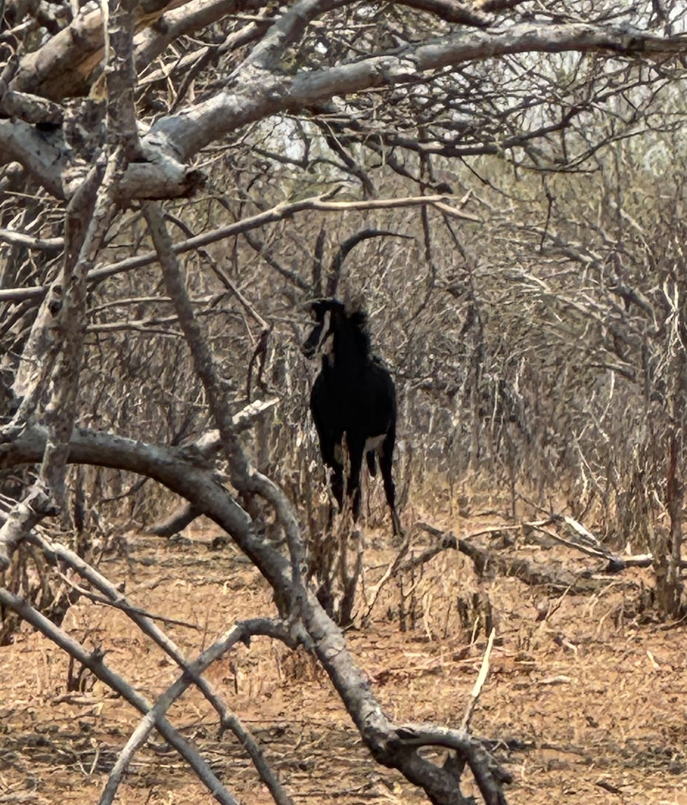
Tuesday, Dec 9 (Puerto Quetzal, Guatemala) - As there is no town at the dock, Janet and I splurged, and joined an excursion to the Mayan ruins of Iximche, the Mayan capital 1470-1524 CE.
We enjoyed an enlightening tour of the ruins (where the royals/leaders lived), learned about the Mayan calendar (which I admit is complex and difficult to remember), their version of soccer, temple construction, and then we observed several spiritual rituals in progress.

Our guide explaining
the Mayan calendar.

A ceremonial alter for initiating
boys into manhood (foreground).
(Note: the stones are small enough
for one person to carry.)

A ritual at Iximche.

A shaman conducting a second ritual.
38) We learned that Iximche's "commoners" lived in Tecpán, the ruin's nearby town.

A busy street in Tecpán.
Mid-day rush?
39) In addition, we learned about "Chicken Buses," rebuilt used US school buses (given larger engines, and with reinforced suspension and roofs). They've gotten that name because locals carry live chickens in their laps when returning home from the market. I spotted a number of them, each uniquely, and colorfully, decorated. (The buses, not the chickens!

A "Chicken Bus."
Wednesday, Dec 10 (Puerto Chiapas, Mexico) - Since Janet and I had not booked a shore excursion here, we explored the small tourist facilities at the dock, and soon returned to the ship, awaiting caviar and cocktails served during our sail-away. I spotted a kettle of vultures, looking for a meal, too, no doubt.
A kettle of vultures.
Thursday, Dec 11 (Huatulco, Oaxaca, Mexico) - Janet and I walked about three miles, exploring the nearby tourist shops and a beach area.

(Another colorful
self-explanatory sign.)
After we'd sailed from port, I spotted one of a number of stunning sunsets that I saw during our cruise.

A Pacific Ocean sunset.
Friday, Dec 12 (At sea) - "Dennis" Wille lectured on Spirits and Seeds: The Natural History of Bats, Agave, and Chocolate.
40) Of the 6.4-thousand species of mammals, 1.4-thousand are bats, though only three bat species eat blood. (Why all the freak out?)
Dr. Sofia Laurein presented The Aztec Empire: The Spellbinding Story of a Lost Kingdom.
41) Originally nomadic, the Aztecs founded their first city in 1325 CE at Texcoco Lake, destined to become modern day Mexico City.
42) Perhaps, they created the first universal educational system, though the elite learned higher skills, such as reading and writing, while the lesser-class commoners learned "trade" skills, such as farming irrigation.
Saturday, Dec 13 (At sea) - Marisa Lino, former US Ambassador, talked about Life as a US Diplomat—Schmoozing and Ducking.
43) The first US diplomat was Ben Franklin, 1776-1785, when he worked to get France to support the colonies against the British.
44) She told us that Albania is the most pro-American country in the world. (I wouldn't have guessed!)
"Dennis" Wille shared about Wings Over the Ocean: Seabirds of the Equatorial North.
45) The term "seagull" is a misnomer, the correct name is Western Gull.
46) Arctic Terns migrate 20K miles to live in an "endless summer."
47) Some birds achieve long-term sustained flight with UBS, unihemispheric brain sleep, aka USWS. (Some reptiles and aquatic mammals also possess UBS capability.)
Sunday, Dec 14 (Cabo San Lucas, Mexico) - Janet and I joined an excursion to San Jose del Cabo, some 46 miles away. We wandered along several streets close to the main square.

(Do I need to say where?)
We happened upon this mermaid, which enticed us into the artist's shop's courtyard. He specializes in welded sculptures, made from various metal scrap, such as washers, bolts, sprockets, and chains. (See for yourself.)

Mermaid at the shop's
courtyard entrance.

Several more metal sculptures
(monkeys in a tree and
female human face).
BTW, you can purchase the human face sculpture for less than $25K! Returned to our ship, I got a good photo of Cabo's iconic arch.
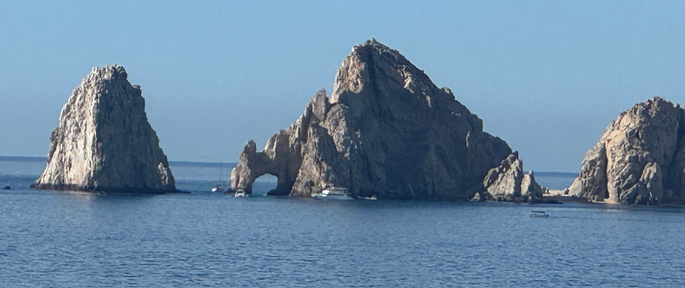
Said iconic arch, El Arco.
After we left Cabo on our northward leg to Long Beach, I spied a pod of porpoises that had set a rendezvous course to reach us, and I watched as our ship slowly pulled away from them.
Porpoises at play in our ship's wake.
And around that same time, I witnessed another ocean sunset.

Yet another fantastic ocean sunset.
(Note: Image unaltered.)
Monday, Dec 15 (At sea) - Jill Dougherty presented Explaining Russia. She provided background information on the lead up to Putin's reign and his drive to reassert Russian power in the world, describing him as a chameleon.
Tuesday, Dec 16 (At sea) - Dr. Sofia Laurein lectured on The Mysteries of Most Enchanting and Intriguing Works of Art.
48) As per fashion of the 15th century, women were depicted as pregnant.
49) Leonardo da Vinci's Last Supper is filled with "hidden" symbols, such as bread on the table represents musical notes from Mozart's "Requiem."
50) Peter Bruegel's (the Elder) painting The Dutch Proverbs contains references to 112 (one hundred twelve) proverbs.
Marisa Lino provided ten basic tips on International Negotiations: Lessons for Real Life. Among those e.g. know your bottom line, be prepared to walk away (if necessary) and negotiating isn't a zero sum game (not about one side "winning").
Alas, our cruise ended in Long Beach. My trip take-away? I've come to believe that every sunset at sea, alas anywhere, is worth witnessing, if for no other reason than to appreciate being alive. (It's a spiritual experience for me!) Oh ... and you need to request the caviar (of life)!
May you enjoy all your sunsets, and walk in beauty.