Carry On, Prim8 (PCT)
- Connard Hogan

- May 19, 2025
- 4 min read
Updated: Jan 7
Bottom line: Into every life, some wind must blow!

Patches of wildflowers frequently
decorated the trail, here in full sun
earlier in the day.
(Photo - courtesy Tallow.)
5/16/25 (Day 0) - Mark R. (Tallow, that is) and I rendezvoused in Idyllwild, CA. in preparation for a hike from Fobes Ranch Trail Junction (Saddle) (PCT mile marker 166.5) to Highway 74 trail junction (near Paradise Valley Cafe)(PCT mile marker 151.9).
After dinner, Tallow retired to his motel room in Idyllwild, while I drove south and camped out at the PCT Junction with Hwy 74 parking lot.
5/17/25 (Day 1 ... and done, “Day of the Wind”) - The next morning, Tallow picked me up at the parking lot, where I left my car. We had breakfast at the Paradise Valley Cafe, then proceeded up the rutted unpaved road to the Fobes Ranch Trail. Near 10 AM, we left Tallow's car.
We'd planned for an overnight on the PCT and would determine our camp location according to our hiking progress.
Though our hike started in full sun, wisps of clouds with a light breeze helped keep us cool. With steady progress up the two-mile trail, we arrived at the PCT junction within an hour.
On the PCT proper, we were starting the last leg of my "previously unhiked section" between the Hwy 74 Junction and Saddle Junction (near Idyllwild). I'd missed this portion of the trail when NOBO (northbound) in 2017, due to trail "fire" closure. In addition, this hike would complete the section, Tallow and I abandoned during our August 2023 trip when remnants of Hurricane Hillary threatened the area.

Prim8 points the way south
on the PCT a short distance
from Fobes Ranch Trail Junction
(mile marker 166.5).
Though the elevation gain of 950 feet to the first, and our day's, high point, provided some slow going, we moved along at a steady pace. The temperature hovered around the mid-fifties, and the occasional westerly wind gusts chilled us when the trail ran along the western side of the ridges (windward). However, we appreciated remaining cool and perspiration free, relatively speaking.
We were treated to great views when the trail crossed a ridge, or ran along it.

Dust obscures the view
of Coachella Valley.
Wind speeds gradually increased, particularly on the ridges and when the trail led us to windward side of the mountains. And since the trail's conditions on the eastern sides (leeward) were more pleasant, we began to anticipate those calmer, and warmer, stretches.
We continued steadily at approximately 2 mph, which we considered quite a good pace. My legs, particularly knees, were holding up well. And when Tallow periodically checked on my condition, inquiring of my opinion about continuing on, I gave him a thumbs up.
With short rest breaks in wind-shadowed spots in order to consume water and snacks , we continued on, noticing the wind gusts growing stronger at each successful ridge and the exposed windward segments. At one point, we joked about the wind gusting to 40-45 mph.
Conditions gradually grew less pleasant with the sun increasingly obscured by clouds and the wind speed increasing. Coming to one ridge crest (perhaps 6,000 to 6,800 feet elevation), Tallow and I had difficulty avoiding being blown over. I imagined my backpack acting somewhat as a wind sail, as I swayed in the gusts. I eyed the fist-sized rocks strewn along the trail and worked to avoid a misstep onto an unsteady rock. Exchanging yells, though only a dozen feet apart, we estimated the wind speed at 70mph. (Wanting to get to the next wind-protected place along the trail, I didn't check our position.) Once out of the wind blast, I told Tallow, "That was treacherous! A wind gust could throw you off balance, cause you to step on an unsteady rock, and then you could sprain an ankle or fall and break your leg."
Our conversation shifted to completing our hike in one day, thus avoiding these weather conditions, or worse, with an overnight on the trail. We hadn't expected foul weather, but knew the temperature would drop further. Issue settled, we'd continue to my car, as possible, with rest breaks, as required.
Per usual, Prim8 complained as we hiked. His protestations grew louder and more persistent throughout the day, coming to a crescendo during the last few miles as calf muscles, knees, feet, and lower back increasingly ached. To be expected, I was dog tired after a seventeen-mile hike in one day, while carrying a twenty-five-pound backpack, and as the trail undulated, alternating between gaining 2,945 feet and dropping 3,230 feet, cumulatively. Our nine-hour hike to my car seemed to take forever. However, though I couldn't fully appreciate the fact at the time, I escaped the development of foot blisters! Yeah!

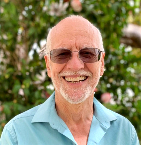
Prim8 rejoices when he arrives
at his car. (Note the haze
created by low lying "clouds.")
So, Prim8 and I have hiked "on" the PCT—fire closure detour notwithstanding—from the Mexican border (mile marker 0) to PCT junction with Horseshoe Meadow (mile marker 751.4)
Tallow and I are planning our next segment, continuing NOBO (northbound) from Horseshoe Meadow to Bishop Pass.
Walk in beauty.


Comments