top of page

You don’t have to save me, you

just have to hold my hand

while I save myself.
Unknown

Blog Posts

As a freelance writer of creative nonfiction, I write to inspire hope for those struggling to heal from trauma. Thanks for reading my posts. If you'd like to read my archived blog posts, use this link.

Bottom line: Traveling is always about experiencing something new!

ree

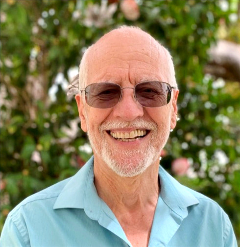
Janet and I pose as our cruise ship leaves Vancouver, BC.


Janet and I recently cruised the Inside Passage, then visited a small portion of Alaska’s interior. Though the climate there is notorious for cloudy weather (and rain), we had good fortune. Most days the sky was clear or only partly cloudy, while the temperatures hovered in the mid-fifties, though had climbed to the mid-seventies in Fairbanks.


Sunday – We passengers, 2262 in all, boarded Holland America’s Nieuw Amsterdam in Vancouver, BC, joining the 864, or so, crew. (Visiting entertainers and musicians are considered crew, though they come and go at different ports.)


Monday – Janet and I settled into a hectic self-imposed routine of eat, drink and attend lectures during our first "sea day." Challenged to avoid over-indulgence, we managed a slight degree of restraint. Daily lecturers onboard, and comments as we toured by bus, provided cultural enrichment. (Interesting tidbits are numbered and sprinkled throughout this blog.)


1) Sea life abounds in colder waters. The temperatures allow the water to hold more saturated oxygen, hence, a more diverse ecosystem, e.g. more plankton resulting in whale migrations.


Tuesday – Our ship docked at our first port, Ketchikan, Alaska's most southern city.


2) Ketchikan is located on an island, and is not connected by bridge to the mainland, or the US road system.


3) Some “streets” are mere wooden walkways and staircases, as there were no motorized vehicles present when the city was originally developing.

ree

A narrow, wooden staircase

"street" in Ketchikan.


4) The iconic “scream” of the Bald Eagle in American film is actually the call of a red-tailed hawk. Bald eagles don’t have a fierce or shrill call, which wasn't considered dramatic enough, apparently. That's Hollywood for ya'.


We visited the Totem Bight State Park, where we learned about the native Alaskan practice of carving totem poles for storytelling, clan identification, and shaming stingy neighbors.


5) The poles tell stories (such as of the creation) as the native Alaskans had no written language. The poles didn't serve as idols for worship, however.

ree

Two "older" totems and clan markings on

the buildings at Totem Bight State Park .

ree

Totem at downtown Ketchikan waterfront.


6) Having a pole carved today could cost $5K-10K per foot!


Janet and I visited the Red Dog Saloon, where we each enjoyed a “Duck Fart,” a delicious shot of a three-liquor combo. (Don’t ask me which liquors, however.)

ree

Janet poses before we consumed our Duck Farts.


Wednesday – By bus from Juneau, we visited Mendenhall Glacier. Though we kept our eyes open for bears, we saw none.

Mendenhall Glacier near Juneau, Alaska.

7) Yesteryear lumberjacks built floating houses (even “cities”) in order to move to various logging sites along the coast or harbors.


8) Alaska’s capital is located on Juneau Island–D’you know the capital of Alaska?–and isn’t connected by road to the mainland.


9) The island has two horse crossing signs, but no horses. The climate is not conducive to maintaining horses year-round, as they develop weather related illnesses. So, the horses that had been there were removed, though the signs were left behind.


10) There are almost as many bald eagles (30K) as humans (35K) on Juneau Island.


Thursday – From Skagway (“Gateway to the Klondike” gold fields) we rode by bus into Canada and to the high plateau just beyond White Horse Pass, over which many gold rushers traversed on their way to the Yukon.


11) The gold rushers were forced by Canadian authorities to trek one ton of supplies with them. That requirement necessitated several trips, and/or use of pack animals, to carry sufficient supplies over the pass, an arduous trek, even without gear. In addition, due to rocky terrain, where legs could easily get broken, it proved easier to portage through snow during the winter. As a result of the hazards, including mistreatment from their handlers, some 3,000 horses died making the trip through the pass, earning it the nickname "Dead Horse Trail."


12) Few gold rushers became wealthy, and tens-of-thousands died during the Klondike Gold Rush, though exact numbers are unknown.


13) As lucrative, even more so, than heading into the backcountry for gold, many people, such as the case in Skagway, went to Alaska to “mine” the gold rushers, e.g. saloon/hotel operators, prostitutes and purveyors.


14) We visited the original cemetery where a number of notable Skagway characters were buried ... and appear to remain so. I took note of several comments on a cemetery sign. (Read the first lines for Frank Reid and Ella Wilson.)

Sign at the first Skagway cemetery.

15) Skagway got electricity before Manhattan!


Janet and I visited the Red Onion Saloon (originally serving as a brothel, as well), where we enjoyed “Reindeer Farts,” (another three-combo liquor shot, though different than the Duck Fart). Again, I don’t know what they were made of, though mine tasted great.

ree

Janet poses at the Red Onion Saloon.


Friday – In clear weather, we sailed into Glacier Bay and cruised to Margerie Glacier at the bay's head.

ree

Margerie Glacier.


16) Alaska has more glaciers than anywhere else in the world!


Saturday – We proceeded to College Fjord. Clear weather continuing, we cruised to the head of the fjord and observed some “minor” calving from Harvard Glacier.

Harvard Glacier from our ship.

Sunday – Our ship docked in Whittier. We disembarked, and boarded a bus for Anchorage. On the way there, we stopped at the Alaska Wildlife Conservation Center, which rehabilitates rescued Alaskan animals.

Two bears observed from

a safe viewing platform.


17) Porcupines are phenomenal tree climbers, though poor at remaining perched. Warning: always check before standing under a tree, least you get impaled by a falling porcupine.


In Anchorage, Alaska’s most populous city, Janet and I strolled a short distance from our hotel to Ship Creek, in a quest to spot spawning salmon, though saw none. Along the way, we enjoyed ice cream at Wild Scoops , then passed the train depot.


Monday – We headed around Turnagain Arm by bus for a look at Cook’s Bay (Yes, that Captain Cook!) and distant view of downtown Anchorage.


18) Cook’s Bay doesn’t have deep water. Large portions of the bay turn to mudflats during low tide, and the fine silt in the bay (about the consistency of baby powder) has been estimated to be 90 feet deep or more. Dredging efforts produce only temporary results.

Cook's Bay mudflats and downtown Anchorage.

On our return into downtown Anchorage, we visited the Alaska Native Heritage Center, where we examined artifacts of traditional tribal Alaskan life.


19) One in five Alaskans have pilot’s licenses. (Bush planes being the primary transportation mode.)


20) It’s illegal to drop moose from planes ... or their droppings. (Okay, I realize this needs some explanation.) At one point, some people, otherwise bored, and with a surplus of moose poo about, would bet on how close to a target they can get moose droppings ... and perhaps a moose occasionally. Hence ... the current law.


That evening, thrilled about, and wanting to take advantage of our two-room hotel suite, Janet and I decided to take cocktails to our room from the hotel bar, Fletcher’s. However, we were informed that would require a hotel security escort. Though Janet was somewhat reluctant, I was all in. Why not? (In the end, our security guard carried our drinks, and we weren’t required to be hand-cuffed!) Though I initially speculated that the hotel didn’t want us to steal their glasses, I concluded that the hotel wanted no liability in serving alcohol that could be carried onto the streets of Anchorage.


Tuesday – We boarded the train for Denali National Park, taking seats in an observation car. On our journey north, we were served lunch.

ree

Glimpse of Denali, 20,310 feet tall, from the train.


21) We passed a line of telegraph poles (protected historical monuments) aside the highway. Some years after the telegraph went the way of the dodo in Alaska, the copper wires were removed, though the poles were left standing. Some citizens thought it unnecessary to pay for their removal, and also thought that they were of some historical value. So, today those poles are like totems … left untouched on purpose, to fall and decay at will.

ree

A "historic monument" telegraph

pole along the highway.


Wednesday – Following our first night's stay at the Holland America Denali Lodge, we were taken on the Denali Natural History Tour, riding by park bus along a portion of the one maintained road. Again, though we scanned the terrain for large animals, such as moose and bear, our efforts were fruitless. Two moose were spotted a a great distance, though they were difficult to see without binoculars. I did see a mated-pair of ptarmigan with several chicks foraging just off the road.


22) Largest of the US National Parks, Denali was established to protect Dall Sheep, the only park established for the purpose of protecting animals.


That evening, Janet and I enjoyed a great meal at the Denali Lodge.

ree

Janet shows off her order of crab cakes, while I

ogle my order of Canadian candied bacon.

(Appetizers, mind you!)


Thursday – We boarded a bus for our transfer to Fairbanks, farther north.


23) “Frost heave,” quite noticeable and a result of permafrost thawing and refreezing, creates a roller coaster effect along portions of the highways.


24) Forest fires are common in Alaska, a natural and necessary process for forest regeneration, e.g. spruce trees require fire to release seeds from their cones. We were required to wait about 20 minutes near one such fire (though we saw no evidence of flames, nor smoke) where the road traffic was escorted and limited to one direction of travel at a time. As I understood the explanation, aspen trees have extensive root systems which can burn/smolder underground for some time, despite the absence of flame above ground. As a result, another outbreak of fire can occur later.


Friday – We visited a portion of the famed Alaska pipeline on the outskirts of Fairbanks.


25) Completed in 1977, it’s still working well, despite an expected lifespan of 20 years. “Pigs” keep the pipe’s inside cleared and the oil flowing. As the pigs move along, they sound like the squeaking and scrapping when glass is cleaned … or so we were told.

ree

Display of a "pig" in a pipeline.

(Note the original spelling of Alaska.)


Following a short walk and train ride, we visited the nearby Dredge 8, the one remaining river dredge maintained for viewing. I imagined the dredge's operation an odd sight, indeed, only requiring enough water to float, as it backfilled its way along.

Dredge 8, in situ.
Dredge 8, in situ.

There, everyone received a fist-sized "grub bag" (sample of alluvial debris) and taught how to pan for gold. My sample yielded $18 worth of gold specks and Janet’s produced $12. What a haul! But it was easy to see how mere small amounts of the glittery yellow mineral could generate a stampede.


From there, we lunched at the Riverboat Discovery dock near the Fairbanks airport, then boarded the paddle-wheeler, Discovery III, for a short ride down the Chena River.


Along the way, our boat paused so we could watch a dog sled demonstration at Trail Breaker Kennel, currently run by Susan Butcher’s daughter.

A demonstration of dog sledding

performed by the daughter of Susan

Butcher. (Note: Susan was a four

time Iditarod winner.)


26) The famed Iditarod Dog Sled Race stems from the need to deliver diphtheria medication to treat an outbreak in Nome in 1925, as there was no other option. Fewer people have finished that race than have climbed Mt. Everest. Generally, there are 26 or 27 checkpoints (depending upon the route selected), and situated 30 to 80 miles apart, over the race length of 1,100+ miles. The sled dogs, huskies, are generally “trotted” at 9 miles per hour, a sustainable speed for them.


The paddle-wheeler continued downstream to the junction with the Tanana River, where we turned upstream.


On our boat's return to the dock, we stopped at the Chena Village Living Museum for several more demonstrations.

ree

Modeling a traditional Alaskan native

dress made of various animal furs.

ree

We learned about about native Alaskan

life and indigenous animal furs.


Saturday – Our trip ending, Janet and I headed to the airport.


Though disappointed about not seeing bears and moose in the wild, or running salmon, during the land potion of our trip, Janet and I wre thankful of the pleasant weather … and the absence of mosquito hordes. Moreover, we took pleasure in availing ourselves of food, drink and the entertainment/lectures on board the cruise ship.


I remain grateful that traveling widens my world view, and brings me great pleasure and spiritual renewal.


Walk in beauty.


  • Writer: Connard Hogan
    Connard Hogan
  • Jul 2, 2024
  • 6 min read

Updated: Dec 5, 2024

Bottom line: Aging pains can be a bee-otch ... particularly when in the wilderness.


6.23.24, Day 0, “Pre-positioning” -


Prim8 and I met Mark R. in Mojave to gas up the car before we drove to Kennedy Meadows, some twenty-five miles into the wilderness west of Hwy 395. Desert temperatures ranged in the 90’s and low 100’s, and we speculated about hiking conditions in the mountains.


Before this trip, Mark had explained he’d changed his trail moniker during his last PCT section hike from the Mexican border northward as a result from his consumption of pemmican. “I’m going by Tallow now,” he’d told me.


No more changes, Prim8 had demanded, not liking the idea.


“Okay,” I’d told Mark, somewhat skeptical. How many more changes will he adopt, Prim8?


Thus, Mark R., formerly known as Cabo, with the previous alias of Wrong Way, will now be referred to as Tallow.


We pre-positioned my car at Kennedy Meadows for our sectional hike southbound. A north to south hike on this section would eliminate the elevation gain of roughly 4,385 feet. If you’re going to do the distance, why not go downhill rather than uphill?


A traffic accident on Hwy 395 south of Olancha delayed our progress to Lone Pine. Dark clouds hung over the mountains to our west and a few large and sporadic rain drops splattered on Mark’s RAV4 windshield as we waited to continue.


By the time of our arrival, the ranger station in Lone Pine had closed, so we proceeded to Lone Pine’s Dow Villa for the night, where I’d reserved a historic room, sans private bathroom. No problem on that front, however the room felt stuffy and the air conditioning blew tepid air, not cool enough for my liking.


The room’s air still and stuffy, Prim8 complained, Hot!


Then, we’ll lay on the bed in the buff without covers or sheet. Not until the wee hours did I feel comfortable.


6.24.24, Day 1, “Our Most Northern Position on the PCT” -


After getting takeout at McDonald’s at 5 a.m.—Prim8 wanted coffee and a chicken sandwich—we drove to Horseshoe Meadow at 10,000 feet.


A posted sign near the trailhead parking lot warned of ACTIVE BEARS.


“As opposed to retired bears,” I told Tallow.

Mt. Whitney and portion of the Sierra Crest
Mt. Whitney (the sharp point) from Near Lone Pine

Under clear sky, Tallow and I hiked to Cottonwood Pass, 11,132 feet, mile-marker 751.4 (according to the FarOut app, which Tallow used, and the PCT posted sign, differing slightly from Half-mile Notes of 750.8).


From the trail junction, we turned south to Trail Pass Trail—I kid you not—at 10,493 feet, mile-marker 744.5. (FarOut indicates the distance is 4.9 miles along the PCT, while Half-Mile Notes says 5.7 miles. Go figure!)


Regardless, we followed Trail Pass Trail back to Horseshoe Meadow.


Boulders in foreground with tree covered hills and Horseshoe Meadow and mountainous terrain beyond
Looking East from PCT Near Cottonwood Pass Towards Horseshoe Meadow and Surrounding Terrain

With clear sky, temperatures for the day ranged from 55 degrees when we left Tallow’s car at 7 a.m. and 80 degrees when we finished the 10.9 mile loop at 12:50 p.m.


Looking across bare ground to intermmediate tree covered hills and Mt.Lanely in the distance
Looking at Mt. Langely from Trail Pass Trail in Horseshoe Meadow

Back at Hwy 395, we stopped at the ranger station for a wilderness permit, then headed the Dow Villa in Lone Pine for the night, I appreciated the slightly cooler temperature in my room compared to the previous evening.


6.25.24, Day 2, “Southbound” -


We presented at the Alabama Hills Cafe and Bakery at 5 a.m. for breakfast.

“Breakfast isn’t available until six,” the gal said, “but you can get coffee and pastry.”


Tallow and I debated, and decided on take-out.


Hungry, Prim8 demanded, Ham and Cheese pastry.


Though I detest processed yellow cheese, I relented, and ordered one along with a cup of coffee.


Breakfast to go, Tallow drove us to the Horseshoe Meadow trailhead parking lot.


I downed a tab of Ibuprofen in hopes of forestalling an increase in knee pain—coming on of late—before we started our hike at 6:25 a.m. The 55-degree temperature felt surprisingly good once we were under way.


Two hours later, we’d hiked 2.2 miles to Trail Pass Trail/PCT junction at mile-maker 744.5. From there, we continued south bound on the PCT.


What? No blister, Prim8 insisted, as if he could order that, when heel pain suggested something amiss.


It’s probably, a blister, fella, but there’s little we can do about that. “I think my foot is trying to grow blisters,” I told Tallow. “I thought I’d solved that problem.” Apparently not, Prim8.


As the morning dragged on, the cool temperature rose to the 80s under clear sky by noon. Though tree cover diminished for stretches, short rest breaks and breezes staved off my total meltdown. Flies and mosquitoes periodically buzzed us. An application of DEET, and our movement along the trail, combined with gusting breezes, prevented their overwhelming us.


Looking east, framed by conifer trees, across mountainous terrain to Owens Lake
Owens Lake from the PCT

We arrived at Death Canyon campground aside a running creek, 8,946 feet elevation, mile-marker 730.8 after a ten-hour hike over 13.7 miles.


After a dinner snack, Tallow bear-bagged our food stash in a tree.


Though no bugs hassled Prim8 and me, once Tallow had set up his tent, I retreated indoors to prevent bugs from getting any ideas otherwise.


A blister! No, Prim8 complained, when I checked my feet and discovered one aside my heel.


Nothing can be done about that. We’ll have to tough it out, Prim8. I’d neglected to bring mole skin or band aids, only carried a small stripe of Duct tape for emergencies. We’ll take another Ibuprofen. I hoped to reduce any and all pain during the night to get better sleep, which had eluded me the past several nights, and maybe avoid muscle stiffness the following morning.


6.26.24, Day 3, “Continuing South” -


6:40 a.m., the temperature near the low 50s, again, felt quite comfortable. Knee, blister and back pains were negligible, but I downed another Ibuprofen as a pain preventative before we continued southbound.


The temperature rose into the 80s. Short breaks to catch my breath under the shade of a tree now and then, helped compensate for the exposure to the sun’s relentless heat.


Tired, Prim8 frequently complained. Stop! 


Okay. We’ll rest a moment, but we need to keep going.


Hurting, Prim8 griped about my on-going heel blister pain, though that felt tolerable, my knee ache, which seemed consistent, and an increasing lower back pain.


Getting old is for the birds, fella. 


I literally limped across the South Fork Kern River bridge (steel bridge) at 7,832 feet elevation and mile-marker 716.5. We’d totaled 14.3 miles distance and a 1,114-foot elevation drop for the day.


Nesting swallows swarmed under the bridge, collecting bugs to feed their young, while Tallow and I filtered cool water to replenish our bottles after he’d set up his tent.


Bridge across Crag Creek, several hikers sitting on the bank, and meadow on one side
"Steel Bridge" Across Crag Creek (PCT mile-marker 716.5)

Exhausted, I reclined on my sleeping pad to eat a light meal and took another Ibuprofen in order to maximize my R&R, rest and recuperation.


Tallow and I decided not to bear-bag our food, as the campground occupation of perhaps a dozen hikers would likely deter most larger critters. As well, we were well out of active bear territory.


6.27.24, Day 4, “Limping to the Finish” -


5:35 a.m. The trail continued away from the stream.

Clover Meadow with Crag Creek meandering through, with a boulder outcrop in foreground and mountainous terrain in background
Looking North at Crag Creek and Across Clover Meadow

We continued over a ridge, then down toward the river again. Remnants of burned and fallen trees, left us with negligible cover from the sun. Hot, miserable and fatigued, Prim8 encouraged frequent breaks, which I took to catch my breath.

I encountered one non-poisonous snake aside the trail before reaching the stream crossing. There, however, an even larger snake—same species, I think—slithered over one of the logs used to aid hikers.


Non-poisonous Snake at PCT Stream Crossing Near Kennedy Meadows

(Courtesy Tallow)


The broad expanse of the Kennedy Meadows, covered with sage brush, made hiking to Sherman Pass Road a continued hot ordeal under unobstructed sun, while the temperature ranged in the 80s. I plodded onward, hiking slowly and taking frequent, though short, breaks, back pain dominating my concern. Thankfully, my knee pain had not increased, while my heel blister had stabilized.


Tallow pointed out a coyote that trotted away, some fifty yards off the trail. “Searching for a wabbit,” he said.


1:50 p.m., we arrived at PCT mile-marker 702.2, elevation 6,009 feet after a 14.3 mile, 9 ½ hour hike.


After retrieving Tallow’s vehicle at Horseshoe Meadows, we spent the night at the Mount Whitney Hotel in Lone Pine—with great air conditioning—before driving home Sunday, 6/28/24.


Note: I’ve decided to stick with the Half-Mile Note mile-marker designations, except for the Cottonwood Pass mile-marker sign, which read 751.4 miles. The remainder mile-marker designations are referenced according to Half-Mile Notes.


Bottom line: Travel is the salt and pepper of life.


Janet, my wife, and I enjoyed our most recent trip, an ocean cruise, to parts of these three countries. Perhaps, the following facts will encourage you to consider a visit to parts of our marvelous planet ... the only one we've got.

ree

Janet and I pose during a two-seater

camel ride on Lanzarote Island.


We first flew to Las Palmas De La Gran Canaria, the largest city on the island Gran Canaria, where we boarded the Seabourn Quest.

ree

A view of the Seabourn Quest (foreground).

1) The Canary archipelago lies about 93 miles off the northwestern coast of Africa and 840 miles from continental Europe (Spain proper). They're governed by Spain, having been"adopted"in 1493. If any blame is to be laid regarding that latter development, I'd point my finger at Columbus, if for no other reason than timing and his encouragement to "sail the seas." (He stopped there for ship repairs in 1492 on his voyage to North America.)


2) The name Canary Islands isn't derived from birds of any sort. Instead, the name comes from Berber shepherd dogs used to control sheep and/or goats. Think Spanish variation of "canine."


3) Volcanic in origin, like the Hawaiian and Galapagos Island archipelagoes, the Canary Islands offer a pristine beauty (except perhaps crowded Santa Cruz de Tenerife). However, the islands are dry like the Galapagos, which, by the way, makes them unsuitable to raise cattle per the lack of sufficient quantities of naturally growing grass.


ree

A small view of the beautiful

volcanic terrain of Lanzarote.


4) The first European desalination plant was built on Lanzarote in 1964 to supplement the meager rain water. The desal water helps wet the whistles of residents and some two million visitors each year.


5) Camels were introduced to Lanzarote in the mid-1800's since they handle the dry conditions better than horses. But since mechanization arrived, I suspect they're only used now to grab a tourist buck or two.


Our herky-jerky two-seater

camel ride on Lanzarote.


6) With a little help, grape vines produce fruit on Lanzarote. The vines there were untouched by Phylloxera—the disease which whipped out continental European vines in the mid-late 1800's—and so weren't replaced by American vines from California.


ree

Grape vines are protected from strong

north wind with local lava rock walls.

(They appear to have been dusted for pests.)


7) Lanzarote boasts the longest lava tube in the world at almost five miles (three-and-three-quarters above sea level and one-and-one-quarter below).


ree

A portion of the exposed lava tube has

been turned into at tourist attraction.

ree

And another portion is used for music

concerts due to the acoustic qualities!


8) The movie "Casablanca" WAS NOT filmed in Casablanca, but instead in Tangiers. That's Hollywood for you!


9) The term "tangerine" originally referred to oranges from Tangiers and its surrounds.


10) The Rock of Gibraltar, the southern most tip of continental Europe, is part of the United Kingdom, ceded three times to Britain by Spain. We were informed that Spain currently lusts over Gibraltar, however vestiges of Spanish colonialism persist in Morocco, an irony difficult to miss. (More on that below.)

ree

A view of Gibraltar Rock, one "Pillar of

Hercules," from an observation deck near the tram.


ree

We were lucky enough to see the

second pillar of Hercules in Morocco,

across the Gibraltar Strait.


11) As part of the defense of Gibraltar in 1787, Lt. General Shrapnel of the British Army, utilized exploding shells. And his name stuck!


12) Gibraltar boasts the shortest land border in the world at approx. one mile.


13) Melilla is one of two Spanish enclaves in Morocco. (The other is Ceuta.) As such it has a highly guarded border to dissuade uncontrolled immigration into the European Union.


ree

A sunset on the Mediterranean from

our cruise ship Seabourn Quest.


Walk in beauty, fellow earthlings.


You can email me:

connard@connardhogan.com

Subscribe to My Quarterly Newsletter

Thanks for subscribing!

Top of page

Background Photo Credit: Nick Kwan/Pexels

© 2023 by Connard Hogan. Proudly created with Wix.com

bottom of page