


Updated: Jul 20
Bottom line: Hiking requires sweat equity and working body parts!

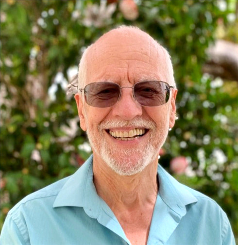
Primate celebrates the completion
of his first 1,000 miles on the PCT!
(He still needs to get to the car,
almost a mile downhill, however.)
6/27/26, Saturday (Day 0) - Prim8 and I rendezvoused with Mark R. (Wrong-way) at the Evergeen Hotel in Shasta City prior to commencing our sectional hike of the PCT from near McCloud, CA (Halfmile PCT Notes, mm 1474.5) to Etna Summit (Halfmile PCT Notes, mm 1581.0).
Our plan: Car camp to allow for day hiking (avoid carrying weight by packing overnight gear, food, bear canister, etc) by alternating our vehicles to "leapfrog" northward (NOBO) on the PCT, though hiking SOBO segments each day. As a result, we needed two sets of overnight gear (tents, sleeping bags, toiletries, etc), one set in each car.
Note: I continue to use PCT Halfmile marker designations, though while hiking, I relied on Wrong-way's references to a FarOut cell phone app. And the two references don't match! The important point for us is to hike the sections that we've not previously done, regardless of the mile marker system we're using!
6/28/26, Sunday (Day 1) - Cabin Creek Trail junction/Road 38N82 (mm 1486.5) to Road 38N53 junction (mm 1474.5, our southern most point on the PCT during this trip)
Following a hardy breakfast at the Black Bear in Shasta City, we parked my car near the trial, then drove Wrong-way's RAV 4 to the Cabin Creek Trail junction.
Beginning our SOBO hike at 10AM under clear skies and in a cold breeze, we soon adjusted to the temperature while hiking. I soon felt wet with sweat, so removed my fleece jacket, and replaced my wool skull cap with a broad-brimmed hat.
Immediately, Prim8 made it clear that he didn't appreciate the pain intensifying in my left leg. I'd figured my arthritic knee would be a problem, though was unsure as to what degree. Regardless, I hobbled onward. During the day, various parts of my left leg, from hip to foot, joined in the pain-fest, as if in a concerted effort to induce me to quit hiking.
Stop! Prim8 demanded.
Okay. You'll get no argument from me, fella.
I paused periodically to catch a breath, and in hopes of easing the pain. Alas, the pain subsided only slightly and briefly, building again once I continued on.
Wrong-way showed me a video and picture that he'd taken of a bear.
Bear! Prim8 gasped.
"I missed it," I said. Just as well, probably.

Can you see the lurking bear?
(Photo courtesy of Wrong-way)
5PM, we arrived at my car, then stopped in Shasta City for dinner, before continuing to Castle Crags State Park campground.
Contrary to my hopes, my leg ached all night, and I had difficulty sleeping.
6/29/26, Monday (Day 2) - Soda Creek/near Interstate Hwy 5 (mm 1502.7) to Cabin Creek (mm 1486.5)
Reloading our night's gear into my car, Prim8 filled with dread and not a happy camper, I knew something had to give. I'll try Advil, Prim8. That should take the edge off, at least.
We left my car at 7:15AM under a thin, high overcast. The cool temperature and breeze felt pleasant, even more so once I began to sweat. My leg discomfort seemed subdued, yet after an hour or so, the pain had returned to the previous day's intensity.
No, Prim8 griped.
We can tough it out, guy, I countered, fingers crossed.
We arrived at Wrong-way's vehicle at 4:15PM, Prim8 giving me fits over my continued left leg pain.
Once again, though in Wrong-way's car, we dined in Shasta City, then car-camped in Castle Crags State Park.
The temperature through the night was pleasant, yet I slept little, and poorly at that.
6/30/26, Tuesday, (Day 3) - Dog Trailhead (mm 1509.2) to Soda Creek/near Interstate 5 (mm 1502.7)
I discovered a blister had grown on the big toe of one foot and, on the other, a small toenail had irritated that reddened toe, despite wearing new boots!
No! Prim8 protested.
Perhaps, I should've broken these boots in beforehand, guy. But, at least, those particular pains are explained! The least of my issues, I trimmed the toenail and wrapped it and the offending blister with tape. As for my sore leg, I downed a couple of Advil along with my usual regime of script meds and supplements.
Breaking camp and repacking the car, we asked ourselves and each other questions such as, Where did I leave that?, Have you seen it?, and Did I put one in this car? We began to realize that tracking duplicate items, one in each car, would be a challenge.
"Hey Mark, remember the 'Catholic Sign of the Cross'? That might help." I gestured as I said, "Keys (car keys, of course), wallet (driver's license, credit card/money), water (for the day's hike), and filter (water filter)." Those constituted the bare essentials to carry, given our current circumstances!
Our day's hike started ~9:15AM from Dog Trail Junction in good weather and cool temperature.
I suffered the pain in my left leg, somewhat reduced by the Advil, while Primate periodically demanded, Stop!
Alright, alright. I usually needed to catch my breath and cool down, per my sweat-fest in full swing as the day's temperature increased. One step at a time, fella.
Wrong-way usually proceeded ahead of me, though waited at chosen spots for me to catch up.
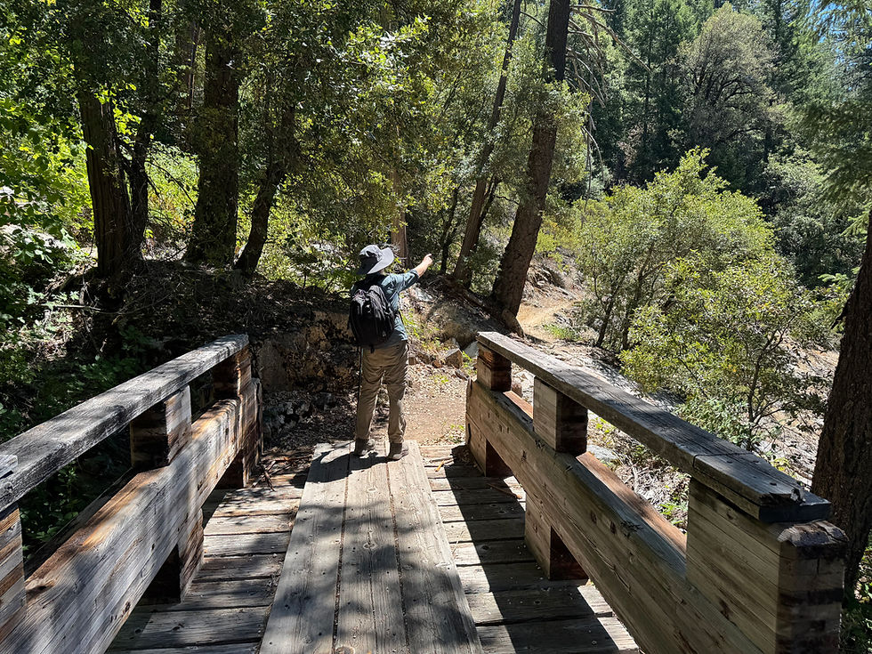
Prim8 points the way
from the wooden bridge
at Winton Canyon Creek.
1:50PM, we arrived at my car at Soda Creek/near Interstate 5 (mm 1502.7), Prim8 screaming about my on-going leg ache.
We headed to Shasta City for some cooked food (and beer, of course), then onto the Gumboot Summit Junction.
"Maybe, we should start our hikes earlier," I opined. "Before sunrise," I added.
Wrong-way agreed, though Prim8 wasn't keen.
Once again, overnight temperatures were pleasant, as I squirmed inside my sleeping bag, shielded from blood-suckers by one-man "Bug Hut." My leg ache just wouldn't quit.
7/1/26, Wednesday (Day 4) - Gumboot Trailhead (mm 1526.7) to Dog Trail junction (mm 1509.2)
Usual routines of breaking camp completed, following our 6AM wake-up, we hit the trail as an array of dawn colors filled the sky.
The downhill portion of the day's segment (some 3,500 feet) felt torturous as my leg-ache increased to a near-intolerable level...and sooner...despite helpings of Advil. Sun rays beat down upon us off and on, and, by Wrong-way's best estimation, the temperature rose to 90 degrees.

Castle Crags as seen
from the west.
Near the end of our day's hike, about 2.5 miles remaining, Wrong-way offered to carry my pack.
Prim8 didn't complain, and I relented, saying, "I don't want you to feel that you need to babysit me." Something's gotta change, Prim8.
I resolved that I'd schedule an appointment with my orthopedist to replace my offending joint, which he'd told me he would do, "...whenever you're ready."
Once at Wrong-way's RAV, we drove to Shasta City for dinner...including beer, before procuring a campsite in the local KOA. Once our camp was set up, we availed ourselves of showers, which for me consisted of rinsing off my residual stink and donning my same sweaty clothing. (I didn't have soap nor clean clothes in Mark's car!)
7/2/26, Thursday (Day5) - Parks Creek Road junction (mm 1540.7) to Gumboot Trail junction/Hwy 26 (mm 1526.7)
At 9:25AM, we left Mark's car in the ample parking area at the road junction, then headed southward in excellent hiking weather.
Unshielded from the sun, the air temperature rose and we were slow-cooked as the day progressed.
A well-deserved lunch break at noon, and about 5 miles along, helped gird me for the remaining 9 miles of the day's hike to my car.

Wrong-way photographs a
few of the many wildflowers
blooming along the trail.
Throughout the day, we were treated to gorgeous views, and my leg pain, though still present, seemed slightly more tolerable. I couldn't determine why, of course, nevertheless felt glad that it hadn't grown worse.

One of the many views
of Mt. Shasta along the trail.
Clouds building, we reached Gumboot Trail junction/Hwy 26 at 5:30PM, fingers crossed that our good weather would continue.
We spent the night under a bright, full moon at Kangaroo Lake campground. Once again, pain in my leg and toes interrupted my sleep.
7/3/26, Friday (Day 6) - Cooper Meadow Trail junction/near Kangaroo Lake campground (mm 1552.8) to Parks Creek (mm 1540.7)
We arose to a clear sky and cool temperature, and started up Fen Trail to the PCT junction, about 1 mile away, at 7:40AM.
Six, or so, NOBO through-hikers passed us in irregular intervals, some chatting with us, some rushing by with little more than a Howdy-do.
At one point, struck by hikers wearing hoodies, I said to Wrong-way, "I don't understand how anyone can stand wearing those in this heat." I grasped the concept of compromise, and hauling fewer articles of clothing, while getting protection from the sun's rays. But still...the heat!
"I guess those are all the rage, now," he replied.
During one rest stop in the shade, Wrong-way noted the temperature to be 65 degrees. It certainly seemed warmer to me!
Our day's hike completed at 3:25PM, we drove to Weed for dinner...and beer, of course. Afterward, we headed to our next car-camp site at Hwy 3/Scott Mountain Summit (mm 1561.2).
Several hours of daylight remaining, and hoping to shorten the next day's segment length, we drove up a nearby gravel road. Thwarted by a locked gate, where numerous parked cars lined both sides of the narrow road, Wrong-way wasn't to be deterred. With his car parked close to the gate, we bushwhacked upslope until we reached the PCT...and right at the Trinity Alps Wilderness boundary (mm 1563.8).
As per the next day's hike itinerary of over 19 miles, and well aware of my leg issue, Wrong-way suggested, "You could hike an additional 2.6 miles segment today to the Highway 3 junction...if you're up to it." (The latter emphasized.) I can do this segment tomorrow, while you wait there with my day pack."
And, though Prim8 catastrophized, I said, "Okay. Seems easy enough, especially without a day pack."
I headed off towards the Hwy 3 junction (mm1561.2) from the Trinity Wilderness sign (mm1563.8).
7/4/26, Saturday (Day 7) - Hwy 3/Scott Mountain Summit trail junction and campground (mm 1561.2) to Cooper Meadow Trail junction/near Kangaroo Lake campground (mm 1552.8)
Wrong-way drove off at 7AM to hike from near the locked gate to the Hwy 3 trail junction where I waited.
In short order, we continued together toward my car at Kangaroo Lake campground some 9 miles on under a cloudless sky with a light breeze. The temperature hovered around 60 degrees, which felt pleasant initially. However, the rising temperature of around 90 degrees, coupled with a clear sky and scarce shade, induced sweating as we hiked.

Can you guess
what this is?
One deer, lying on the trail, arose as we approached, then wandered down the trail until it reached brush, moved off the trail a few feet, and began to browse. I couldn't help but appreciate, and feel awed, that the deer wasn't afraid of us.

Checking us out.
(Who, me in a hurry?)
After the 1.25-mile downhill slog along Fen Trail, we reached my car at 3:22PM. Straight away we drove to Callahan, where we had dinner, and...you guessed it...cold beer.

Only one reason that
I love visiting saloons!
From there, we located an unoccupied horse camp some miles drive away. I wondered about the odds of stepping in droppings as I parked adjacent to a hitching post.
Settled in early, about sunset, we hoped to rise at 3:30AM for another earlyish start.
The night temperature proved pleasant as the waning moon advanced across the sky.
7/5/26, Sunday (Day 8) - Carter Meadows Summit/Hwy 93 trailhead (mm 1581.0) to Trinity Wilderness boundary sign (mm1563.8)
I'd had a pleasant night, though not without some leg discomfort. By this point, I'd concluded that was a new norm, at least during this trip. More Advil, please!
We started our day's hike at 4:30AM. Once the sun had risen, thin, high clouds helped shade us...somewhat.
We encountered deadfall trees on numerous occasions, which necessitated awkward clambers over the larger, more inconsiderably placed, trees.
Wrong-way assisted me over a number of the more difficult ones, and at one point referred to my hiking pole as a"cane."
Am I that decrepit? I wasn't quite sure how to respond to that, and, being thankful for the assistance, said nothing.

One of the many spectacular
views along the trail.
The day had grown hot before we finished our marathon hike of 11 hours, I felt knackered and relieved.
We stopped in Callahan a second time (nearest town on our route) for a beer! Then, we proceeded to Etna, where we consumed a cooked meal, along with more beer. We recognized a number of NOBO through-hikers whom we'd passed on the trail, though we didn't converse with them. (They appeared occupied with their acquaintances.)
7/6/27, Monday (Day 9) - Music Creek Trail junction (mm 1592.9) to Carter Meadows Summit Trailhead (mm 1581.0)
Up at 4:30AM, we drove 9 miles to the parking area of Music Creek nearest the PCT. At 6:05AM, we missed the trail leading to the PCT initially, so backtracked to the parking area before spotting it as it headed off at an oblique angle.
"No wonder we missed it," I said to Wrong-way.
With thin, high clouds above, and in a cool, light breeze, we switch-backed through burned forest and low brush for about 1 mile, until we reached the PCT junction at 7:10AM.
Some segments of trail crossed rock faces.

Prim8 ponders the trail ahead.
We finished our day's PCT hike of 11.9 miles at 3:30PM. Without delay, we drove to Etna for a dinner and beer, then on to Idlewild Campground to spend the night.
We planned for another early start, with a wake-up at 4:30AM, in order to beat the heat...or at least some of it.
It seemed hot, though I had no way to know the temperature for sure.
7/7/26, Tuesday (Day 10) - Etna Summit/Sawyers Road junction (mm 1600.7) to Music Creek Trail junction (mm 1592.9)
Following our routines of sorts, we broke camp, then headed off for the Etna Summit/Sawyers Bar Road junction (our northern most point on the PCT during this trip)
The sky was cloudless when we left the car at 5:50AM. The trail ascended about 3,000 feet over the next 3.5 miles, and my leg pain remained at a constant level, and mostly tolerable. As it turned out, my leg functioned quite well on the uphill, though I loathed the upcoming descent.
Again, we were treated to gorgeous views of the mountains and valleys eastward.
Sure enough, my leg pain increased as we descended, but I knew I could tough it out. Had to!
Prim8 celebrated our achievement of hiking our first 1,000 miles on the PCT when we arrived at the Music Creek trailhead, despite the fact that we still faced a descent to Mark's RAV nearly a mile away. That seemed to take forever, though we arrived at 11:35AM.
Knackered, Prim8 and I headed to Red Bluff for the night, and hopefully a good shower, restful sleep and breakfast before driving the remaining several hundred home. (Still a long drive!)
7/8/26 - Still knackered when I arrived home, I sought out my recliner in order to begin recovery.
Distance covered on the PCT this trip: Road 38N53 trail junction near the McCloud River (mm 1474.5) to Etna Summit/Sawyer Road (mm1600.7) 126.2 miles! A considerable distance, in light of my left leg problem. Thus, our accumulated miles on the PCT passed 1,000 miles on our last day's hike.
Time to junk the old knee, and opt for a newfangled trade-in!
Note: Though we spotted numerous animal species, we encountered no trail angels. Apparently, they don't exist in northern California!
Walk in beauty.
