
- Connard Hogan
- Apr 12, 2022
- 12 min read
Updated: Jan 8
Bottom Line: What goes up, always come down . . . usually in an undulating fashion.

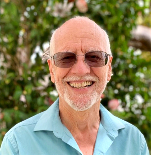
Prim8 (Primate) points the way.
(Photo credit: Mark R.)
3/30/22 (Silverwood Lake to Power Lines) - Mark and I rendezvoused at the Cajon Junction McDonald's at 6AM, per plan, while the black of night and the cold temperature suggested winter, rather than spring.
Following the purchase of coffee and a breakfast snack, we drove to the terminus of our day’s hike, located several miles off the paved road, and parked my car under a power line tower at PCT mile marker 340.5. Then, we carpooled, down the ungraded rock cluttered and rutted road, continued over civilized roadway to our starting point at the Silverwood Lake day use parking area.
We’d start in pleasant cool temperatures, but with an unobstructed sun everything would warm soon enough.
“Feels pleasant at the moment, “ I told Mark.
* * *
The trail led us on a semi-navigation around Silverwood Lake, past Cleghorn Picnic Area, then under Hwy 138, all the while temperatures rose to the mid-70’s.
My legs and feet complained.
Fingers crossed, Prim8, that we don’t have a major problem coming on.
* * *
When we’d arrived at my car, PCT mile marker 340.5, “Not bad, “ Mark said, once he finished his calculations. “We hiked 2.4 mph, if we include our lunch break, and 2.7 mph without.”
“Yeah, pretty good,” I said. Fairly respectable, don’t ya think, Prim8?
Sore, Prim8 moaned.
Let’s hope it isn’t worse tomorrow, Prim8.
The elevation gains and losses along an undulating trail are nothing to laugh about. Though the differential elevations of our day’s start and finish amounted to 670 feet, we’d gained 987 feet at the highest point. Worse, the trail inevitably headed up, then down as it snaked through the mountains.
After a Mexican dinner in Phelan, I settled into my hotel room for the night at Cajon Junction and fell asleep with little difficulty.
(Our day’s distance? 17.8 miles.)
3/31/22 (Power Lines to 3N31 / Crossing I-15, southbound) - My phone alarm sounded all too early, as is always the case for me at 5:30AM.
Again, Mark and I rendezvoused at McDonald's for some light breakfast and coffee.
Let’s not make this a habit, I thought.
This time, however, my gear occupied my trunk, as we would relocate farther along the trail after today’s hike.
As today’s objective appeared more downhill going southward, than going northward, we opted to reverse our general hike direction.
I’m not a purest! Either direction will work for me, as long as I hike every mile. Even if I skip a section here or there, and hike them out of sequence.
We left my car at mile marker 340.5—same as yesterday—then drove Mark’s four-wheel drive SUV to our starting point at mile marker 356.2, a junction with an unpaved road, designated 3N31.
We started our hike at 7:40AM, my feet and legs recuperated from yesterday. Cool temperature with occasional breezes helped ward off an out-of-control sweat fest, and as well reduced my body’s demand for water.
All part of the plan, as a calculated risk, we carried less water—the bulk of weight in many a pack.

“Wrong-way” Mark poses at a water
cache at the Swarthout Canyon Road
junction. I counted seventy-one
one-gallon water jugs and most
were full. We required none,
however.
If large animal encounters in the wilderness are a hiker’s concern—lions, tigers and bears, oh my—maintaining a supply of water, a constant and underlying consideration, dominates all decisions.
For most of the day we hiked in the open, with only occasional shade from trees.
As yesterday, we maintained a respectable pace, though I admit I slowed on a number of the uphill portions, particularly as the day progressed.

Prim8 spies I-15 in the distance.
(Photo credit: Mark R.)
The trail descended towards the highway, though rather than taking a straight path and in keeping with the PCT trail route designers sense of humor, we crossed over one railroad track, then under another via a culvert. Who thought that up?

Prim8 reaches for mile-marker
420 on the culvert wall.
(Photo credit: Mark R.)
About noontime we passed under I-15 via another culvert, even wider and made of concrete. One serious drainage structure, indeed.
Wouldn’t want to face this after a serious rain, Prim8.
I tiptoed through what appeared to be a trickle of water, inches deep, as my eyes adjusted to the tunnel’s low-light conditions. I followed Mark’s route, angled towards and hugged one side, hoping an unseen hole with my name in it wasn’t lurking.

After existing the culvert, we
passed “the sign.” (Famous or
infamous? I can’t say.)
Mark and I parked our behinds on a nearby picnic table—how convenient!—on the eastern side of I-15 and just feet beyond said sign.
“Would you hike to McDonald’s from here?” Mark asked.
“No way, I’d hike there today,” I retorted. Who knows, if I’d been hiking the trail for a few days?
Yeah, milkshake, french fries, Prim8 said.
You’re just a glutton, Prim8.
As Mark and I munched our uncooked food, we watched traffic move along the highway and the trucks headed uphill as they queued at the weigh station.
Though we’d lose elevation overall on today’s section, we’d gained elevation here and there, but between I-15 and my car, we were on an uphill leg again.
Up, down, up, down. If that isn’t a PCT hiker’s motto, it’s their bane.
Why are we doing this, Prim8?
Not relishing the remaining elevation gain for the remainder of today’s stretch, but looking forward to my car’s softer seat, I felt ready, mostly, to push on when we’d eaten our fill.
* * *
At my car near 2:20PM, Mark reported, “We made good time, 2.2 mph, if we include our lunch break, and 2.7 mph, if we don’t.”
“Like yesterday,” I said. I’ll take it, Prim8. No questions asked.
Driving the ungraded rock-cluttered and rutted road to retrieve Mark’s seemed less of good idea as my car’s undercarriage scraped and banged against rocks.
Mark’s comments reflected his growing concern as we crawled up the road. Finally, he said,
“I’m concerned about this. Turn around here and I’ll walk the remaining distance to my car.”
“Are you sure?” I said.
Though willing to offer my car’s best effort, I wasn’t gonna argue Mark’s idea.
“Okay’” I said.
“Go on down. Wait for me at the road junction,” he said.
My drive down didn’t seem as bad as the drive up.
* * *
Once we’d rendezvoused again at the junction with Swarthout Canyon Road, we headed to Santa Clarita.
Mark had explained to me earlier, referring to the next 60-odd mile northbound stretch, “Accessibility to the next sections of trail looks problematic and we’ll encounter snow.”
Colder, slower, more gear. “Whatever we miss now we can fill in later after the snow melts,” I said in agreement. No need to torture ourselves, Prim8.
Who was I kidding? My legs, feet and knee were getting tortured . . . and plenty, snow or no snow.
* * *
We checked into our hotel rooms in Santa Clarita, showered, jaywalked the street for dinner, then prepared for another early hike start tomorrow.
I mulled over my gear options. What to carry? Do I need my larger, expedition pack? Or can I stuff everything into my day pack? Would tying my sleeping bag to the top of my day pack work well enough?
Planning for an overnighter on the trail, with a hike distance of 27 miles between our vehicles, we both wanted to haul as little weight as possible. No way I’d hike that distance without a significant rest stop.
I opted to use my day pack, go bivy style, as the weather predicted no rain. I stuffed my pack with a thin ground cover, an inflatable sleeping pad, and tent fly to keep dew off my sleeping bag—just in case—as well as a long-sleeved wool shirt, a thin rain jacket and dried food. Then, I added about one-and-a-half gallons of water.
Jeez Louise, water is heavy!
Finally, I tied my lightest, and newest high-tech, sleeping bag onto the pack using a bit of cord Mark had given me. Needless to say, most of the weight of my load consisted of water. No stove, no tent, only the barest of essentials, bearing in mind elevation, likely nighttime temperatures and an absence of precipitation in the weather report.
4/1/22 (Into the Wilderness: Mill Creek Summit to Messenger Flats Campground) - Up before the sun, again, we consumed a hardy meal at a Denny’s before our wilderness overnight experience.
Last meal for a condemned man? I wondered.
My car parked at Indian Canyon Trailhead, Mark drove us to the Mill Creek Summit Fire Station at PCT mile marker 418.6, where the paved road, N3, crests a pass on its southbound way towards Greater Los Angeles.
Though quickly tired by the immediate, and generally sustained, ascent of nine hundred feet, I hiked along at a decent pace—I thought—while Mark left me in the proverbial dust.
No surprise, my feet and legs complained from the start. Wouldn’t let up.
What do I need to do, Prim8? At least my feet haven’t started a blister convention.
I slowed my pace here and there to catch my breath and allow my bones a short rest, while Mark forged ahead without problem.
Trees, downed by strong winds, no doubt, blocked the trail occasionally, and provided me opportunity to catch my breath while Mark cleared selected branches.

A grand vista with a reminder
of past conflagrations.
Cresting a hill or arriving at a pass is cause for many a hiker to celebrate. Well, me for sure. Every hiker understands the joy of a change of pace, where the trail’s grade changes, sometimes upward, sometimes downward, sometimes leveling. Whatever provides a change of the stresses and demands on muscles and joints can bring some relief, if only temporary.
Yay, we’re almost there, Prim8.
When I caught up to Mark at the pass, our day's highpoint, where he’d paused for a rest break—and allowed me to catch up, I suspected—“I think that’s Messenger Flat Campground down there,” he said.
“Yep,” I said, “has to be.” I hoped so, anyway.
Switchbacks down the 45-degree slope for about a half-mile led to a dirt road which, within a short distance, passed a telltale area, flat with scattered tall trees and clear of brush.
“Looks like there are buildings down there,” Mark said.
I pulled a long stare, scanning for signs of life, though seeing none, said, “I think you’re right.”
* * *
I coasted downhill—felt like I did, anyway—along the switchbacks, though I remained acutely aware that select parts of my body took issue with my hiking.
Got to? Prim8 asked.
Suck it up, fella. No choice, I replied.
Mark and I had the campground to ourselves when we arrived at 2:30PM, PCT mile marker 430.4.
Presently, several issues arose. What to do about a possible bear visitation in the night? Where should we locate our bivy bags?
After surveying the area, I elected to bivy next to a fallen tree. “That tree will help keep the wind off,” I explained to Mark.
He placed his sleeping gear near mine. “I’m going to leave my pack and food in the outhouse,” he said.
“Hmm, good idea,” I said. “I hadn’t thought of that. No way a bear could get in there. Bears aren’t stupid. They manage to break into cars when they spy food through a window.”
Dinnertime came early, our feast consisted of uncooked foods. Mark primarily chowed on meat sticks of various flavors, while I polished off my lunch leftovers of a hunk of cheese, salami slices and piece of bread.
“I think I deserve some dessert,” I told Mark, and sucked the contents from a vanilla-bean flavored GU Energy Gel packet.
When I hung my pack next to Mark’s on a convenient hook inside the toilet stall. That door will keep ‘em out, Prim8. I doubt there’s a bear around who can turn a doorknob.
Other hikers began to arrive as if in a drawn-out queue. By dusk six northbound thru-hikers had swelled the campground occupation to eight.
Mark and I socialized with two hikers from Europe, and exchanged tidbits of information about the trail condition, both ahead and behind. They were pushing hard and several days earlier had hiked through the snow conditions that Mark and I had so easily by-passed by car.
Better you than me. I knew the advantages and relative ease of day hiking will disappear somewhere up the trail, when I’ll pound ground and face overnight camping for more than one night at a stretch. And Mark and I, knowing we needed to prepare, we’re using this overnight hike as a learning opportunity to provide us answers to logistical issues we’ll face.
One of the two European hikers had run out of food, while the other’s supply neared its end.
Not a good thing, Prim8.
Though they indicated they would resupply in Acton tomorrow, Mark and I contributed some of our dried food to the needier of the two.
No reason not to do so. What goes around, comes around, I reasoned.
At a respectable time, I tucked into my sleeping bag with two Ibuprofen on board, hoping they would alleviate the aches and pains in my lower extremities, particularly my knee. My feet felt reasonably good. Apparently, my latest gear selection had helped prevent a major outbreak of blisters.
At least some things were going my way, though for a hiker there’s always tomorrow’s challenges.
4/2/22 (Return to Civilization: Messenger Flats Campground to Indian Canyon Trailhead) - Snug and comfortable at first, I hoped for sweet dreams in the wilderness. The sounds of the breezes, as well as humans in the campground, quieted.
Aroused by the unmistakable arrival of a vehicle, followed by opening and closing doors, I wondered what would come next.
Great! A noisy, rowdy, unsympathetic group, unappreciative of a hiker’s day’s toil, gonna keep me awake?
Silence returned shortly after, however, and yet, I could hardly return to sleep.
Crap, why are my feet cold? I’ve got my socks on.
Worse, I verged on shakes and shivers. Verged, I say, not shaking or shivering, but wondering when that might start. Well, one question answered. Clearly, my bivy configuration won’t cut it when temperatures drop below the 40’s.
Regardless, I laid there, if for no other reason to rest as much as possible, while I pondered how to warm my feet. Wiggling my feet occasionally didn’t work. Not one iota.
* * *
“Connard, time to get up,” Mark said.
“Okay,” I responded. May as well, Prim8. Won’t get warmer laying here.
In the dark, and knowing it would take a few minutes to warm up with activity, I considered that preferable to feeling chilled with inaction. Besides, we had miles to go before we slept again.
The through-hikes gone,I spotted two vehicles the parking area, while a tent stood nearby.
Pleased that I’d re-stuffed my day pack with gear in short order, I listened as Mark chatted with weekend campers who’d soon have the area to themselves.
Chat-fest over, Mark pulled out his supply of pain meds. “Want an Ibuprofen? Or two?” he said to me.
“Just one,” I said. “Might help take the edge off, but I don’t want to over do it.”
We walked away from the campground about 6:15AM.
Crud, my knee’s already complaining, Prim8. Hope this isn’t going to be a major problem for my future hiking.
The weather continued to be mild, as predicted. Though the sun glared steadily in a cloudless sky, periodic breezes and tall trees on the north-slope sections of the trail helped me remain cooler, and reduced my need for water.
But the trail didn’t relent. Up, down, up, down.
More than once I cursed those who’d laid out the trail route. Some perverse since of humor . . . or sadism?
The views helped compensate for my misery as I trudged along, Mark usually some distance ahead.

Sunrise over Soledad Canyon.
As is the case, the trail moves on to other terrain, with the scenery of a different ecosystem, confronting the hiker with different challenges.

Looking towards the Vasqeuz
Rocks formation, as best I could
tell, the scenery appeared bleak.
Not infrequently, I cajoled myself. Around the next bend, Prim8 . . . over this next rise . . . the next patch of shade . . . pause to take a photo . . . time for a swallow of water. . . . The need to motivate myself remained never-ending.
Slow means success, Prim8. At least, I hoped it did. And I tracked my water consumption, knowing I lightened my load with each swallow, at the same time calculating the distance to the creature comforts, and water, awaiting at my car. You know, creature comforts like conforming yourself to a plush seat with the backrest reclined and legs outstretched, while blasted by a copious breeze.
Mark paused at a trail, dirt road junction.
I spotted my car, some half-mile distance down the road and perhaps a thousand feet lower in elevation, even before Mark pointed it out.
“See your car down there?” he said.
“Yeah,” I said, relieved.
“I think we need to follow the trail from here,” he said, “rather than take the road.”
“I wouldn’t want to take the road and find out the trail ended up there anyway,” I said.
Down now, Prim8 insisted.
No way, Prim8.
I hated to continue along the trail, lose sight of my car, and contour around the mountain. But, bound and determined, I wasn’t gonna cheat. I don’t want to reclimb this hill later, Prim8.
Plodding along, I knew, or trusted so, each step brought me closer to my car, though Prim8 protested, Wrong way, wrong way.
Just a little farther, Prim8!
When I rounded the mountain, where the trail runs nearly vertically above the paved road, I sighed with relief.
Almost there, Prim8. Let’s not fall off the mountain, though.
A few additional belabored steps and I reached my car at PCT mile marker 444.1.
We’d done it, one step at a time! Our overnight trek amounted to 25.5 more miles.
(Prim8’s accumulated PCT progress: 381.7 miles.)
Walk in beauty.


